| 
|
|
Italy, Europe and World Maps reference list
|
|
Road atlases and maps of the town. Static maps and interactive maps to find roads, towns, places and to plan your journey in Italy and abroad.
|
|
| |
|
Interactive Maps |

|
|
|

One of the best road atlas, max details for city maps included most of small towns, route calculation, automatic zoom.
|

Windows Live Local has to be one of the most addictive Web search tools out there. Windows It lets you soar like an eagle through all the major cities without ever leaving your desk.
|

Interactive European Maps, with route details, real time traffic data and informations for companies.
|

One of the most complete road atlas used in Italy and Europe, many informations related to the Michelin Guide, route calculation, easy customization.
|

European cities maps, route calculation inside cities, both by car or pedestrian.
|

City map service, with customizable chart, reference points for pedestrians and car drivers.
System in use by:
|

Highly detailed.
Aerial photograph superimposable for England.
|

Italian city map
In collaboration with Pagine Gialle Seatcon, best to find and to locate authorities, companies, public offices, shops.
System in use by:
|

City maps, road atlas, route planning. |

City maps, road atlas, route planning.
System in use by:
|

Road maps with monuments of main italian cities.
System in use by:
|

Fine details for Europe and USA cities.
The first interactive maps service in the world
Aerial Photos available for USA cities.
|
| |
|
 |
|
Road Atlas and simple maps |

|
|
|

Classic Italy road map composed by 24 tables.
|
|
Italian topographic maps, for online consultation or PDF dowwnload.
|
|
Italian historical centers maps of Miland and Lombardia, Milan metro map.
|
|
Road maps for Sicily and other italian islands.
|
| |
|
 |
|
Highway maps |

|
|
|
|
| |
|
 |
|
Virtual Earth from satellite |

|
|
|
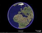
 Google Earth
The well known Google Earth, a 3-D mockup of the planet generated from satellite photos.
|

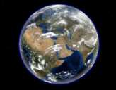
World Wind lets you zoom from satellite altitude into any place on Earth.
Leveraging Landsat satellite imagery and Shuttle Radar Topography Mission data, World Wind lets you experience Earth terrain in visually rich 3D, just as if you were really there.
Virtually visit any place in the world. Look across the Andes, into the Grand Canyon, over the Alps, or along the African Sahara.
| |
Other virtual globes
There is the list of virtual globes temporally (a mix of open source, commercial, internet-based, standalone, multi-planetary, etc.)
- Wayfinder Earth link
- ESRI ArcGIS Explorer link
- Volvo Ocean Race Virtual Spectator link
- Erdas Imagine Virtual GIS link
- Punt link
- Ping 3map link
- EarthSLOT link
- osgPlanet link
- ESRI ArcGlobe link
- Eingana link
- SINTEF Virtual Globe link
- Celestia link
- Skyline Software TerraSuite link
- GeoFusion GeoPlayer link
- SRI Terravision link
- Lunar Software Earthbrowser link
- Hipparchus link
- Mark Pesce's WebEarth
- Microsoft MapPoint Virtual Globe
- GeoVirtual GeoShow3D link
|
| |
|
 |
|
Other useful resources |

|
|
|
|
Other useful resources where find more informations:
|
| |
|  |
|
|
| 
|
 |